SAOCOM Missions
Space


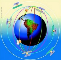
SIASGE
 Italian-Argentine satellite for the benefit of the Society Emergency Management and Economic Development
The SIASGE, Italo-Argentine Satellite System for Emergency Management, will consist of two satellites SAOCOM provided by CONAE and four satellites of the Italian COSMO-SkyMed constellation, Italian Space Agency (ASI).
This set of satellites to obtain accurate and updated information of fire, floods, volcanic eruptions, earthquakes, avalanches, landslides and mudslides.
The six satellites shall be placed at the same altitude in polar orbits, on different orbital planes, in such a way that the whole set will work as one instrument with a huge vision width on the Earth. This will enable monitoring in almost real time, since the informatio shall be updated every 12 hours, which is particulary necessary for the monitoring and tracking of disaster evolution.
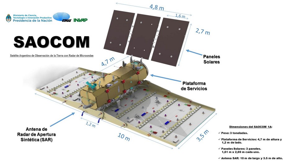
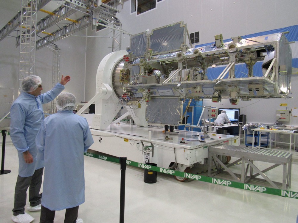
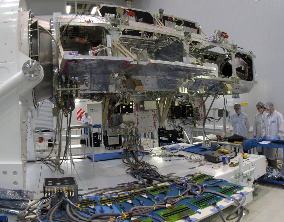
SAOCOM (Microwave Earth Observation Satellites)
Mission is composed of 2 high-capacity satellites, the largest ever built in the Southern Hemisphere, weighing 1600 kg each. Their main purpose will be monitoring for the prevention of disasters by means of the Synthetic Aperture Radar (SAR).
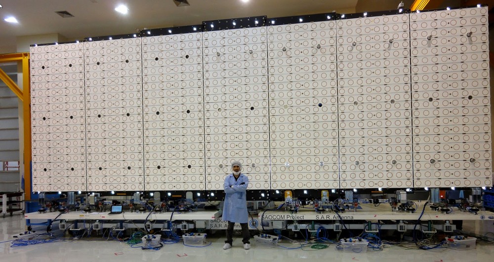
The radar emits high power microwave pulses using a large antenna of 2.5 x 10m, and will be able to inspection situations before or as they occur, no matter the hour or weather conditions.
Unlike normal cameras, SAR is able to see through clouds or in the dark of the night. Furthermore, its synthetic aperture may steer a beam of a fixed antenna as if it were directional. This capacity allows the camera to focus on a particular point or to scan a large area of the surface, without the risks and mechanical complications involved in moving a remote antenna or the waste of energy necessary to move the whole satellite to change its position. As is emits L-band microwaves, the SAR will be able to detect objects larger than 8 m.
Besides, SAOCOM satellites will carry and infra red camera capable of detecting heat sources and to prevent fire in deserted areas. They will form part of the joint Italo-Argentine SIASGE constellation (an emergency management system) together with Italian satellites that will carry radars using the complementary X frequency. The US Space Agency, NASA will collaborate in this project providing critical platform components.
Technical Characteristics
A synthesis of the SAR instrument general characteristics is depicted in the table below.
Central Frequency: L Band (1,275 GHz)
Observation orientation: To the right (with the possibility to also make observations to the left)
Orbit type: frozen orbit; quasi circular; sun-synchronous; height: 620 km (approx.); ascending node local time, 06:12.15 am; orbit revisit cycle: 16 days (for one satellite); 8 days (for the constellation)
Space resolution: 10 to 100 m
Coverage: 30 to 350 km
Angle of incidence: 20 to 50 degrees
Absolute radiometric accuracy: 0,25 dB (for the entire Mission)
Relative radiometric accuracy: 0,05 dB (within the scene)
Further SAOCOM 1A characteristics:
Operation modes:
Operative, all quality requirements and resolution specifications are satisfied
Technological, technological innovations aiming to performance improvement assessment are included
Calibration, gathering measurements for SAR instrument calibration and noise estimations.
Available polarizations:
Single (SP), the system transmits and receives in the same linear polarization (horizontal-H or vertical-V), meaning HH or VV.
Double (DP), the system transmits in a given linear polarization and receives the two linear polarizations simultaneously, meaning HH and HV, or VV and VH.
Quadrupolar (QP), the system transmits alternately both linear polarizations and receives simultaneously, meaning HH, HV, VH and VV.
Circular Linear (CL-POL), the system transmits one circular polarization (right or left) and receives two linear polarizations simultaneously, meaning right-H and right-V or left-H and left-V.
SAOCOM 1A operation modes:
StripMap SP, DP y QP
TOPSAR Narrow SP, DP y QP
TOPSAR Wide SP, DP y QP
Technological mode:
TOPSAR Wide CL-POL (designed exclusively for soil moisture assessing in the Pampa Húmeda region)
It is foreseen to have the following processing levels:
Annotated Raw Data-AR, Level 0: the product is obtained from the binary data stream (Raw Data, RAW) and includes formatted synchronized data.
Single Look Complex-SLC, Level 1A: the product is generated from Level 0 products. Complex data in slant range, radiometrically calibrated with no geometric corrections.
Detected Image-DI, Level 1B: the product is generated from Level 0 products. Data projected to ground range, radiometrically calibrated and georeferenced.
Ground Ellipsoid Corrected-GEC, Level 1C: the product is generated from Level 0 products, radiometrically calibrated, geocoded and georeferenced.
The Mission has three demonstration projects in course, based on soil moisture assessment over the Pampa Húmeda region (on surface and deepness). The area of interest includes almost 70M hectares and it is required to obtain soil moisture maps with a 700 x 700 m space resolution on an operative basis. Taking this into account, the instrument is required to perform acquisitions over the area of interest with a frequency better than 6 days and with a given dynamic range in order to allow Sigma Nought measurements between -35 to 5 dB.
Two of the three demonstration projects are devoted to Agriculture (carried out jointly with the Instituto Nacional de Tecnología Agropecuaria-INTA) and the third is devoted to Hydrology (carried out jointly with the Instituto Nacional del Agua-INA), with the following main objectives:
Optimize sowing time and the use of fertilizing agents in the area of the Pampa region,
Optimize the use of agrochemicals for crop disease control,
Minimize the economic loss due to flooding and optimize the activities regarding future flooding warnings in Argentina.
For more information go to Spanish Section
Status
Sep. 2018
SAOCOM 1A will be equipped with a L-band (about 1.275 GHz) full polarimetric Synthetic Aperture Radar (SAR). The primary purpose is to mitigate the effects of natural disasters.
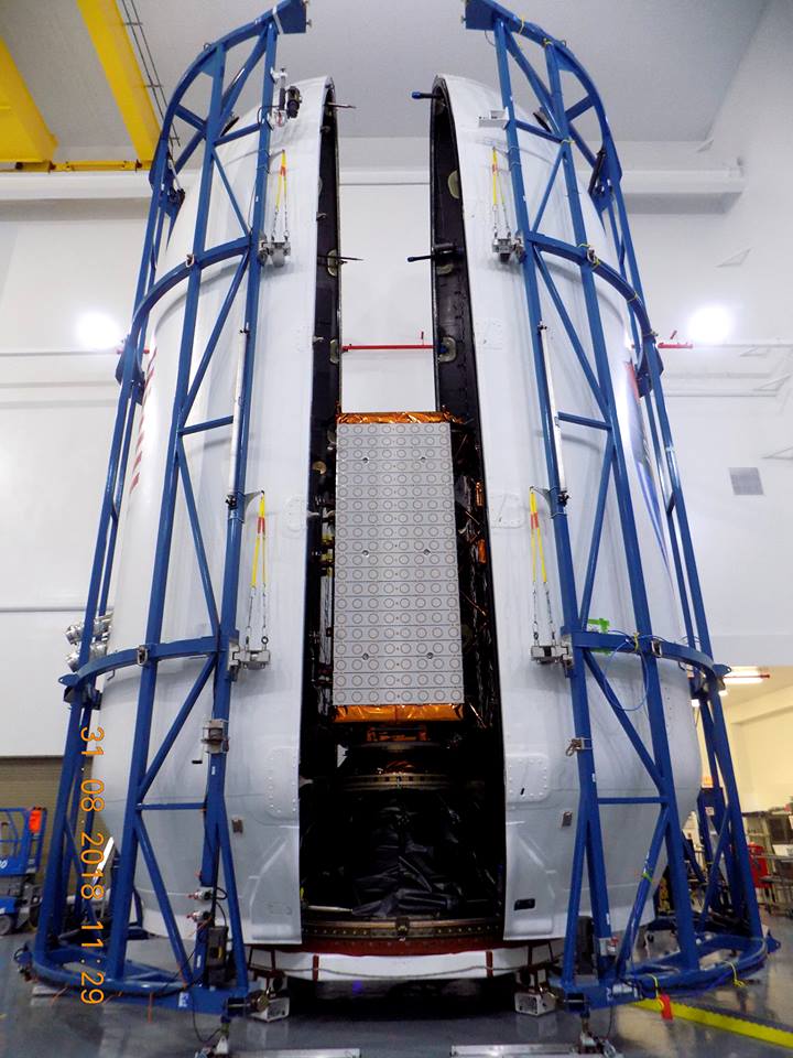
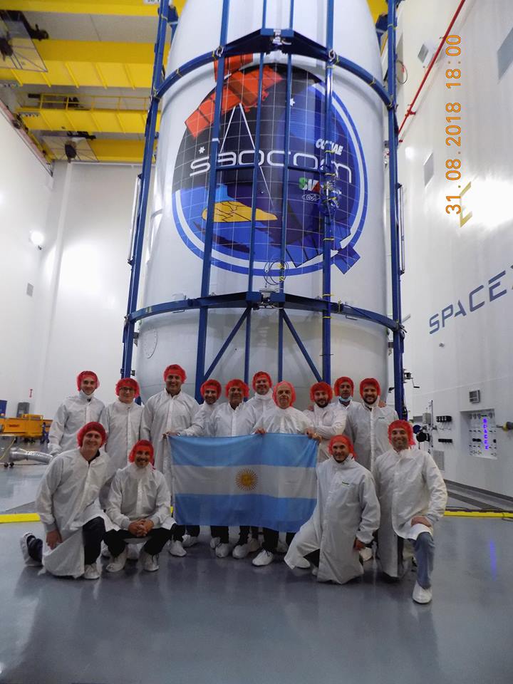
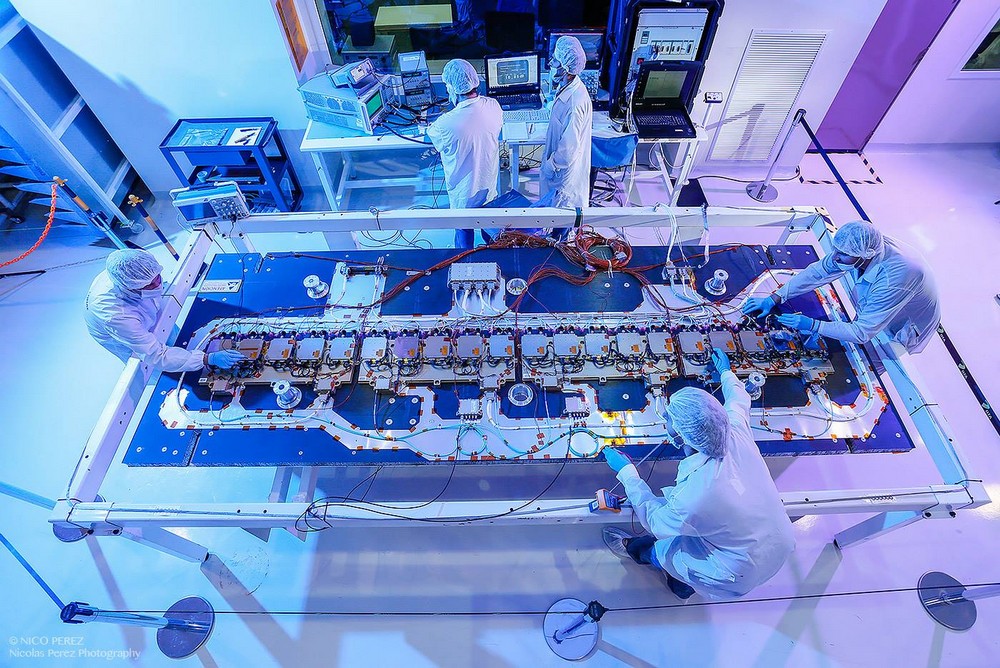
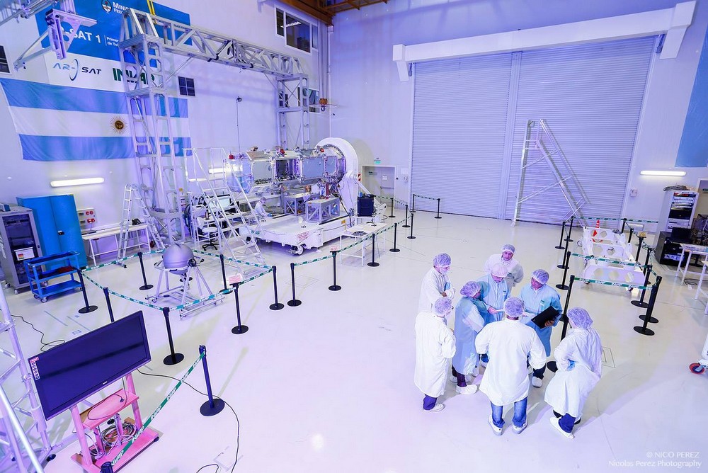
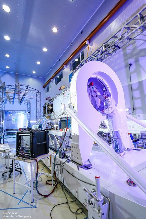
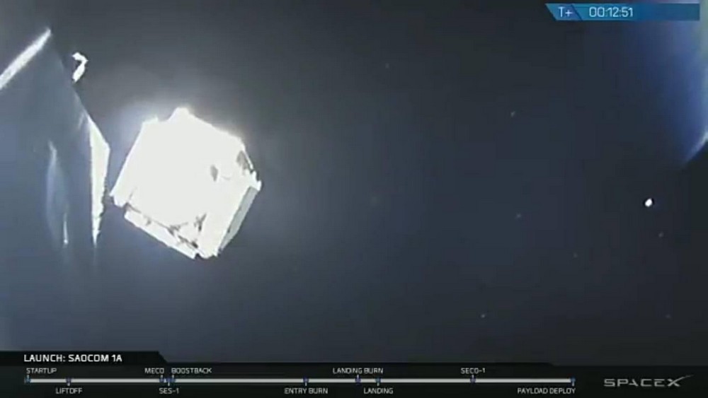
Images of SAOCOM 1A


SAOCOM 1B
Aug 30th 2020 2319 utc